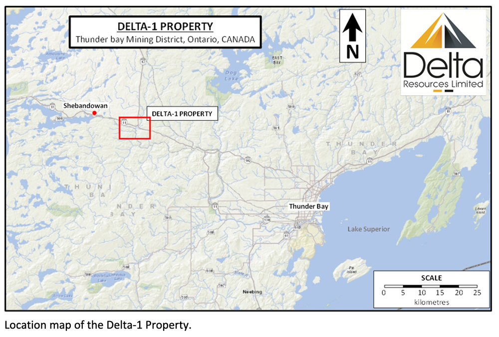
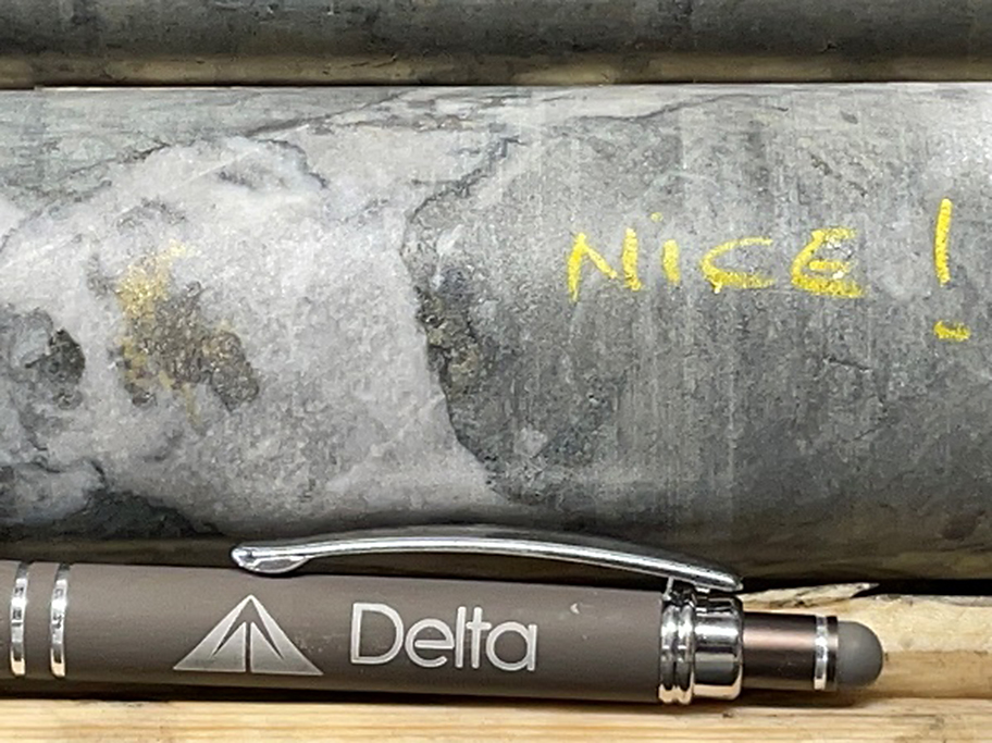
Delta-1 Gold Project
The past-producing INCO-Shebandowan Mine, sits immediately north of the property, where INCO Limited produced 9.29MT @ 1.75% Ni, 0.88% Cu and 1.83 g/t PGE between 1972 and 1998. As a results of this operation, INCO Limited had a stronghold on the Shebandowan Belt for decades, exploring for Cu-Ni-PGEs. The belt was largely known as a “Copper-Nickel” Belt.
As a result, the region has seen very limited gold exploration. Prior to Delta, most of the property has been dormant since the late 1990’s, with limited localized programs in 2003, 2008 and 2020.
DELTA EXPLORATION HISTORY:
Since optioning the Delta-1 Property in 2019, Delta has carried out several limited exploration programs in the area adjacent to the Gravel Ridge property. A summary of the exploration work by Delta Resources is provided below:
2019: A six-hole, 1009 m diamond drilling program which showed a very wide zone of low-grade gold mineralization intersected over a 200 meters strike length and extending vertically from the surface to a depth of up to 110 meters.
2020: A 134 sample glacial sediments sampling program which indicated a major in till gold anomaly at the Eureka zone, a second anomaly three kilometers SE of the Eureka gold Prospect, and a Cu-Ni-Co geochemical anomaly west of the Kasper Gold Occurrence.
2020: A geological mapping, prospecting & sampling program which defined the mineralized zone at Eureka as consisting of a broad envelope of low-grade gold, ranging from 0.2 g/t Au to 0.4 g/t Au. This gold halo was defined over a strike length of 1.2 km and a minimum width of 300 m, therefore significantly expanding the lithogeochemical gold halo that was previously defined during the 2019 drilling program.
2021: An eight-hole, 1370 m diamond drilling program which expanded the mineralized zone from the surface to a vertical depth of 150 meters.
2022: An eleven-hole, 3693 m diamond drilling program that has produced the best drill-hole interval so far at the Delta-1 project with hole D1-22-18 returning values of 5.92 g/t gold over 31.0 metres(Including 14.80 g/t Au over 11.9 meters and Including 72.95 g/t Au over 2.2 meters), hole D1-22-24 returning 6.49 g/t Au over 10.0 metresand hole D1-22-25 returning 130.0 g/t Au over 1.0 metre, 1.20 g/t Au over 20.0m and 1.66 g/t Au over 18.1 metres.
2023: Delta completed sixty (60) drill holes (D1-23-26 to D1-23-86) for a total of 19,620 metres. The Eureka Gold Deposit was defined over 2.0 kilometres, extending from surface to over 250 metres vertical depth and with a true width of 10 to nearly 85 metres.
Delta’s 2024 Exploration:
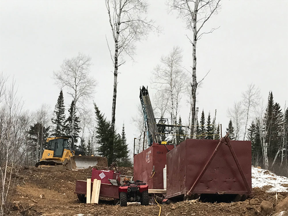
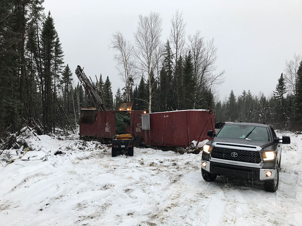
Between January and May 2024 Delta completed a total of twenty-nine (29) drill holes and two (2) drill hole extensions for a total of 9,286 metres (complete 2024 drill results are posted under the tab Project/Delta-1/Table of Results 2024).
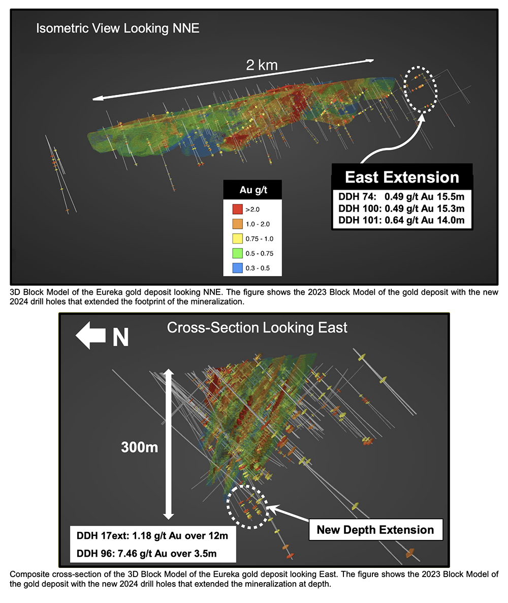
The objective of the drill campaign was to increase Delta’s gold inventory at Delta-1, increase Delta’s knowledge of the gold deposit and to expand the deposit size through exploration holes to the east, west and at depth. See the map showing the location of drill holes and a 3D model of the gold mineralized zone.
Below is a Map of the Delta-1 Eureka Gold Zone, showing the location of all Delta drill holes to date. The map also shows the alteration corridor that is hosting the gold mineralization and the East Extension of the mineralized zone. This alteration corridor is defined over approximately five kilometres of strike length at Delta-1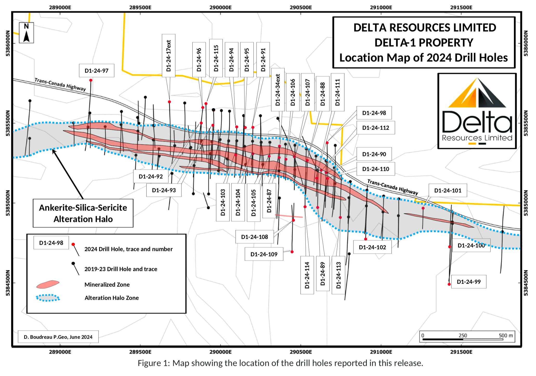
Gold mineralization occurs within a broad corridor of highly altered (ankerite-calcite-sericite-silicification and albitization) rocks exhibiting highly anomalous gold values of up to 0.2 g/t gold.
Higher-grade mineralization within this corridor is associated with a stockwork of quartz-ankerite-pyrite-gold veinlets, with increased density of these veinlets generally proportional to increased gold grade.
The gold mineralized zones have so far been intersected for a strike of approximately 2.5 kilometres, with a higher-grade core extending for nearly 950 metres. So far, the mineralization extends from surface to a vertical depth of approximately 300 metres. Mineralization strikes approximately 100 to 120 degrees azimuth, with a dip of 75-80 degrees north (shallower dips of 50N are observed in the western portion of the zone).
Higher-grade, wide ore shoots are observed and appear to be plunging approximately 40 degrees towards the west, within this structural corridor. Similar ore shoots are often observed in structurally controlled gold deposits and often occur with a certain periodicity. The currently defined ore shoots are open at depth.
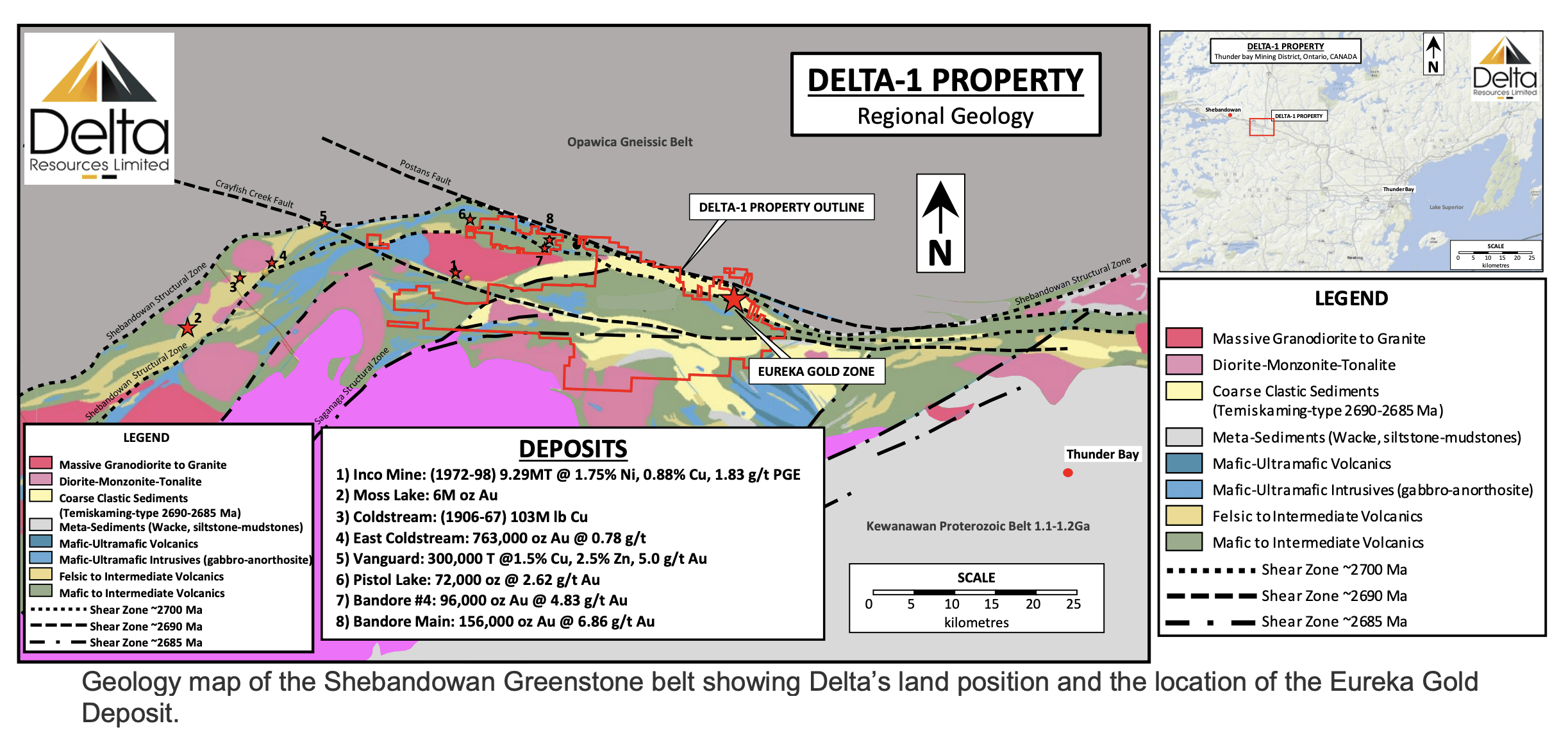
Regional and Property Geology
The Archean supracrustal rocks of the Shebandowan greenstone belt belong to one of two contrasting packages of metavolcanic and metasedimentary rocks: 1) an early suite of mafic to felsic metavolcanic rocks of the Burchell and Greenwater assemblages; and 2) a later suit defined as the Shebandowan assemblage, consisting of sedimentary and volcanic rocks that unconformably overlie, and locally straddle, the previous two assemblages (Williams et al., 1991).
The older Greenwater assemblage (ca. 2720 Ma) referred to as Keewatin-type, is dominated by mafic to felsic metavolcanic rock cycles consisting of tholeiitic to calc-alkalic andesite, dacite and rhyolite, along with some komatiitic rocks (Rogers and Mercier 1995). It comprises three generally south-younging, bimodal volcanic cycles (Williams et al. 1991).
The younger Shebandowan assemblage (∼2690 Ma) unconformably overlies the Greenwater assemblage and is dominated by clastic metasedimentary rocks, with subordinate calc-alkalic to alkalic intermediate metavolcanic rocks and intrusions (Williams et al. 1991). The clastic sedimentary rocks of the Shebandowan assemblage are often referred to as “Timiskaming-type” because of their similarity to the Timiskaming group rocks of the Abitibi greenstone belt (Cooke and Moorhouse 1969). The Sedimentary rocks of the Shebandowan assemblage are thought to have deposited in fault-bounded basins related to the Shebandowan Structural Zone during regional transpressive deformation at circa 2690 Ma.
In the Shebandowan Belt, the unconformity between the Greenwater and Shebandowan assemblages has a close spatial association with numerous gold occurrences (Stott and Schnieders 1983). The same spatial association is common throughout the Shebandowan, Wawa and Abitibi belts.
Structural Features:
The Shebandowan Structural Zone (ca 2700 Ma) is a deep-seeded structure that marks the boundary between the Quetico and Shebandowan greenstone belt. At least three deformation phases are thought to have taken place (Williams et al. 1991). The Shebandowan region is affected by major northeast and northwest-striking faults.
The Saganaga Structural Zone (ca 2690 Ma) is documented as a sinistral, continental-scale shear zone striking over 200 kilometers from Minnesota northeastward. Timiskaming-like pull apart basins also mark the length of this structural zone with early alkaline volcanics and related intrusions dominating northeast basins.
The Shebandowan region is also affected by late major northeast and northwest-striking faults. The Crayfish Creek and Postans faults are late-stage dextral sense structural zones that may have reactivated the Shebandowan Shear Zone. Later-stage vertical movement is recorded by near-vertical lineations on the fault system at the Wawa-Quetico subprovince boundary.
Regional Mineralization Models include Orogenic Gold Mineralization (Moss Lake, Pistol Lake and Bandore), VMS Mineralization (Coldstream) and Magmatic Ni-Cu-PGE Mineralization (Shebandowan “Inco” Mine).
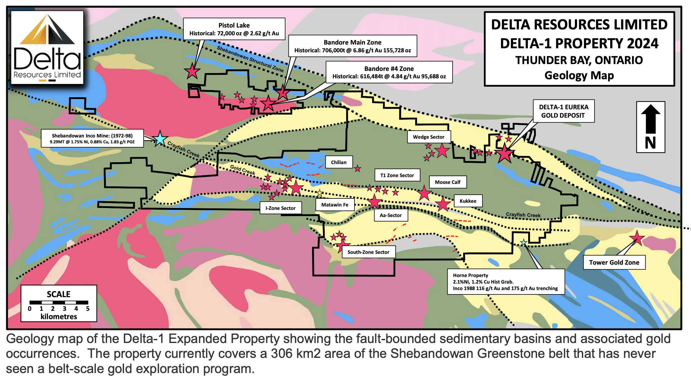
The Immense Potential of the Delta-1 Expansion Property
Having identified the geological setting and controls of the gold mineralization at the Eureka Gold Deposit, Delta geologists looked elsewhere in the Shebandowan Belt, for a similar geological signature. Several fault bounded basins of Temiskaming-Type sediments of the Shebandowan Formation have been identified by the Ontario Geological Survey, some five (5) kilometres south of the Eureka deposit.
Delta elected to expand the Delta-1 property to what now covers 30,600 hectares (306 km2) to cover:
- A 27 km strike extent of the Shebandowan Structural Zone which hosts the Eureka Gold Deposit as well as the Band-Ore Main Zone (Historical Resource of 706,000T grading 6.86 g/t for 155,728 gold ounces) and the Band-Ore Zone 4 (Historical Resource of 616,484T grading 4.84 g/t 95,688 gold ounces)*.
- A 29 kilometre strike extent of each of the gold endowed Crayfish Creek and Gold Creek Shear Zones as well as a several other shear zones with similar characteristics as the Shebandowan Structural zones.
These shear zones are crustal-scale structures that unconformably juxtapose Shebandowan Clastic sediments (of Temiskaming-Type) with the volcano-sedimentary rocks of the Greenwater Formation. A geological setting equivalent to the geological setting of the Eureka Gold deposit.
The structures clearly show signs of gold endowment as shown by the number of important gold occurrences associated with them (where they have been explored). Gold occurrences such as the I-Zone, South Zone, T1-Zone, Kukkee and Moose Calf all occur along a 20 kilometre segment of these shear zones (see geology map of the Delta-1 Expanded Property).
* Note 1: The Band-Ore mineral resource estimates are considered to be ‘historical’ in nature and are not compliant with National Instrument 43-101. Delta has not done sufficient work to classify the historical estimates as current mineral resources or mineral reserves in accordance with NI 43-101, however the data is relevant as it is indicative of potential mineralization on the Property. The Band-Ore Main Zone historical resource comes from the Report on Shebandowan Property Conacher Township Thunder Bay Mining Division Ontario for Band-Ore Resources Ltd., effective date February 15, 2006 with lead author David Gunning, which references the following reports: Report on Property of Band-Ore Gold Mines Ltd., Thunder Bay, Ontario, with lead author J.S. Crosscombe, Mining Engineer, effective date May 15, 1947. The Band-Ore No. 4 Zone historical resource comes from 1982 Diamond Drilling Report and Pre-Evaluation Study on the Band-Ore Option Conacher Township Ontario for Mattagami Lake Exploration Ltd. with lead author Karl J. Huska, December 1982.
Property-Scale Gold mineralization
Eureka Gold Deposit:
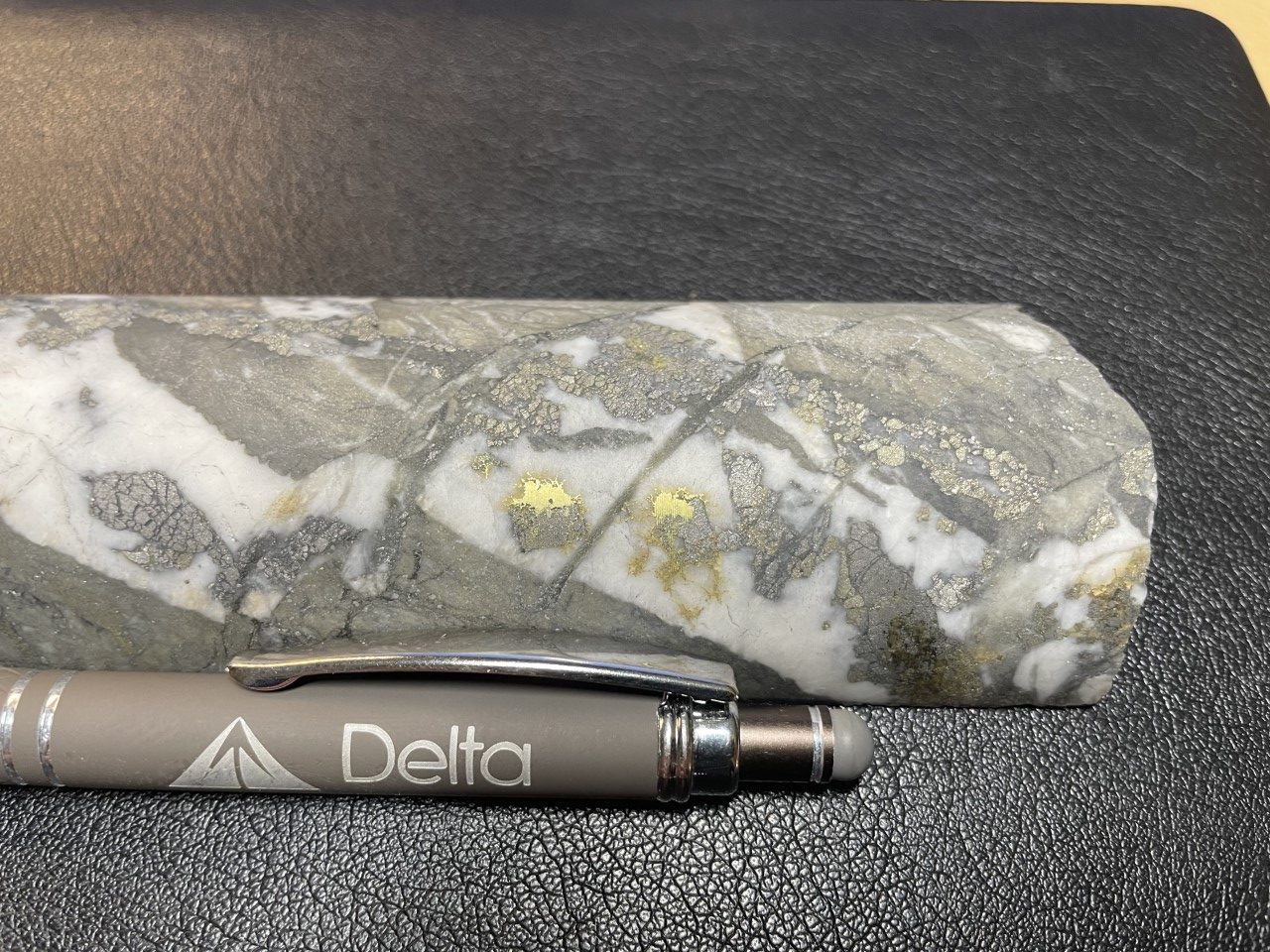
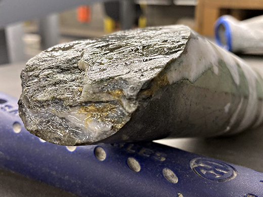
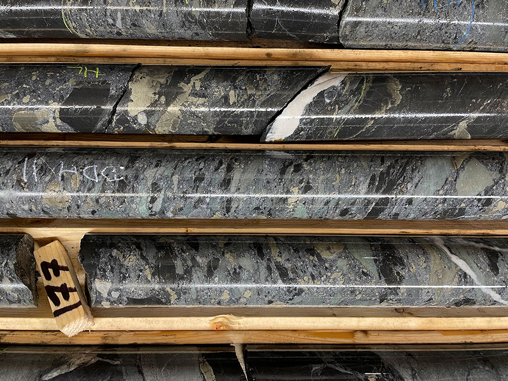
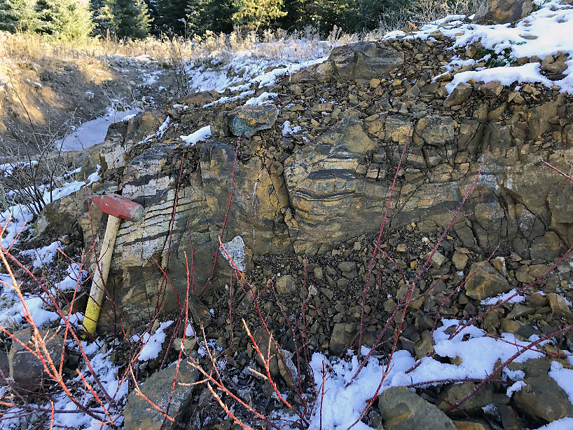
Gold is hosted by a stockwork of quartz-ankerite-pyrite veinlets ranging from 1mm to 10cm in width. Multiple generations of mineralized veinlets are observed. Occasionally, fine grained disseminated visible gold is observed within the veinlets. The quartz-ankerite-pyrite gold veinlets crosscut every lithologies.
Lode-Gold-Type quartz veins of up to 4.5 metres in width as well as gold-bearing silica-flooding zones have also been observed within the deposit
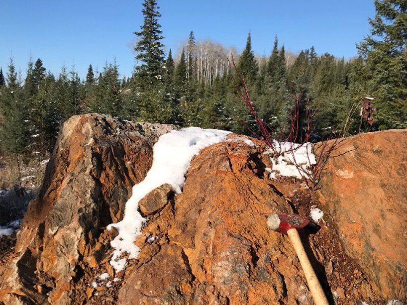
Host rock alteration consists dominantly of intense, texture-destructive ankeritization, silicification, albitization and sericitization combined with trace to 2% disseminated pyrite and trace arsenopyrite. At surface, rocks are weathered a dark rusty brown. The rock is massive, fine-grained, yellowish buff to pale grey with a common dusting of very fine-grained disseminated pyrite. Even without any veinlets present, the host rock typically contains highly anomalous gold.
Feldspar-phyric monzonitic to dioritic dikes are locally altered and are spatially associated with the gold stockwork.
Wedge, Chilian, T1, Moose Calf and AA Gold Occurrences:
Mineralization is similar in style as the Eureka Gold deposit, with gold being associated with a stockwork of quartz-ankerite-pyrite veinlets. Alteration also consists of ankeritization, silicification, albitization and a broad halo of potassic alteration.
Kasper, Mattawin, Kukkee Gold Occurrences:
Gold is hosted by horizons of sulphidic and graphitic chert, chert breccia iron formations. The rocks are ankeritized and silicified and characterized by an abundance of sulphide (dominantly pyrite with lesser arsenopyrite).
I-Zone Sector of Gold Occurrences:
At the I-Zone, as many as thirteen (13) gold bearing syenitic to granodioritic dikes were uncovered by INCO Gold between 1987 and 1989, over a strike length of 3.2 kilometres.
The mineralized dikes are 1-5 metres wide and some have been followed for up to 900 metres of strike length. Mineralization is typically associated with late NS-trending quartz veins up to 30cm wide.
The area has been tested by limited, near-surface grassroots-type drilling which returned intercepts such as:
- 3.28 g/t Au over 14.6 m; Inco Gold 1987-89
- 4.32 g/t Au over 41.0 m; Ovalbay 1995-97
- 4.53 g/t Au over 14.4 m; Ovalbay 1995-97
- 4.36 g/t Au over 20.4 m; Ovalbay 1995-97
Inco Gold also carried out a bulk cyanide test on the mineralization and recovered 96.2% of the gold.
In 2008, Mengold Resources collected a 1000kg mini-bulk sample on the mineralization and recovered grades of 9.9 g/t gold. The work was completed just before the financial crisis of 2008, and Mengold never returned to the property.
South Zone Sector:
The South Zone sector consists of tree (3) gold occurrences lying within 400 m of each other.
Gold mineralization is hosted by quartz-sericite-pyrite schist, cherty horizons and rhyolite breccias and is typically associated with base metals values such as copper and lead.
Mineralization at the South Zone appears to have gold-rich volcanogenic affinities similar to the Between 1988-1989, Inco Gold reported drill intercepts of 0.7 g/t Au over 39 metres and 1.63 g/t Au over 7.5 metres. Inco Gold also reported channel samples averaging 3.02 g/t Au over 2.43 metres over a strike length of 54.9 metres.
Gold mineralization at Delta-1 occurs as two distinct types:
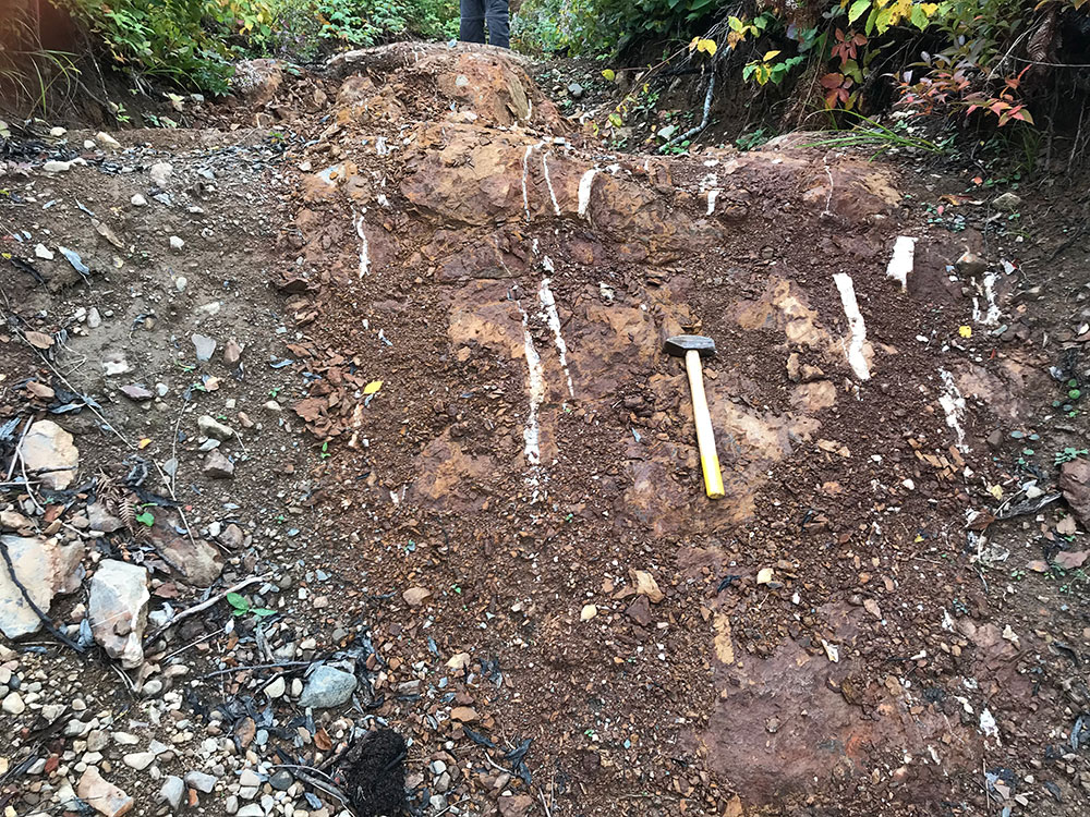
The Kasper, South, Creek and Mattawin gold occurrences are hosted by thin horizons of sulphidic and graphitic chert and chert breccia (perhaps sulphidic iron formations). At the Kasper gold occurrence, a banded iron formation is also observed. The rocks are ankeritized and silicified and characterized by an abundance of sulphide (dominantly pyrite with lesser arsenopyrite).
Kasper Gold occurrence. To the left, a sulphidic chert looking west (grab sample 8.72 g/t Au). To the right, the spatially associated banded iron formation at Kasper looking north (grab sample 0.08 g/t Au).
At the Eureka and Wedge Gold occurrences gold is associated with an organized stockwork of quartz-ankerite-pyrite veinlets ranging from 1mm to 10cm in width. Multiple generations of mineralized veinlets are observed. Occasionally, fine grained disseminated visible gold is observed within the veinlets. Although visible gold is dominantly associated with the pyrite at the walls of the veinlets specks of visible gold also occur in the central portions of the quartz veinlets.
In drill core, gold grade is directly proportional to the density of veinlets present. The presence of a single 1cm veinlet in the core can result in gold grades exceeding 1.0 g/t Au over a one metre interval.
Gold mineralization is late and the quartz-ankerite-pyrite gold veinlets crosscut every lithologies.
Host rock alteration consists dominantly of intense ankeritization, sericitization, albitization and silicification, with lesser sericitization combined with trace to 2% disseminated pyrite and trace arsenopyrite. At surface, rocks are weathered a dark rusty brown and rock textures are completely obliterated. In drill core and in fresh surface, textures of the sandstone, feldspar-amphibole-phyric intrusive and volcanics are locally recognized but typically also obliterated. The rock is massive, fine-grained, yellowish buff to pale grey with a common dusting of very fine-grained disseminated pyrite. Even without any veinlets present, the host rock typically contains highly anomalous gold. At Eureka, the extent of the alteration a mineralized halo containing 0.2 g/t Au to 0.4 g/t Au is defined over a minimum strike length of 1.5 kilometre and a true width of up to 187 metres.
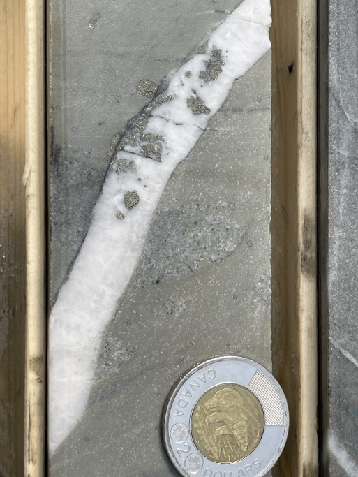
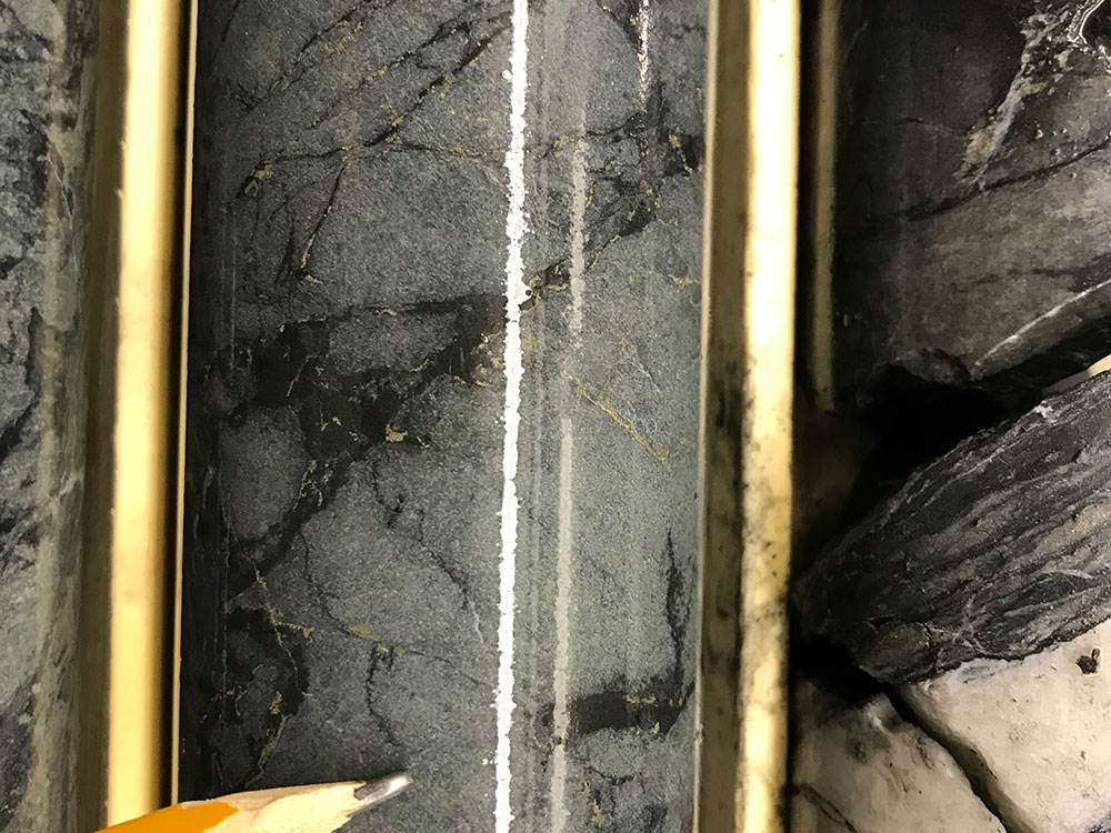
Gold Mineralization. Left: Quartz-ankerite-pyrite veinlet in sandstone from drill hole D1-21-10 at 79.9m. This single veinlet is responsible for an assay of 0.78 g/t Au over a 1 metre interval from 79m to 80m. Right: Quartz-ankerite-pyrite veinlet with visible gold in volcanics from drill hole D1-21-18.
REFERENCES
BAJC, A.F. 1999. Results of regional humus and till sampling in the eastern part of the Shebandowan greenstone belt, northwestern Ontario; Ontario Geological Survey, Open File Report 5993, 85p.
BROWN, G.H. 1995. Precambrian geology, Oliver and Ware townships; Ontario Geological Survey, Report 294, 48p.
COOKE, D.L. AND MOORHOUSE, W.W. 1969. Timiskaming volcanism in the Kirkland Lake area, Ontario, Canada; Canadian Journal of Earth Sciences, v.6, p. 117-132.
PARKER, D. 2020. Assessment work report on the Aurogen Project, Delta-1 Property. Mining District of Thunder Bay, Ontario, 40p.
ROGERS, M.C. AND BERGER, B.R. 1995. Precambrian Geology, Adrian, Marks, Sackville, Aldina and Duckworth townships; Ontario Geological Survey, Report 295, 66p.
STOTT, G.M. AND SCHNIEDERS, B.R. 1983. Gold Mineralization in the Shebandowan Belt and its Relation to Regional Deformation Patterns; in The Geology of Gold in Ontario, Ontario Geological Survey, Miscellaneous Paper 110, p.181-193.
GIRARD, R. AND BURDEN D. 2021. Report on an April 2021 Drilling Program at the Delta-1 Property, Thunder Bay District, Ontario, Canada. Shabaqua Area, Shebandowan Belt. IOS Services Géoscientifiques, 205p.
ROYER, G. 2007. Goldie Township Property Diamond Drilling Report, 112p.
TESSIER, A.C. 2022. Report on a November 2019 Drilling Program at the Delta-1 Property, Thunder Bay District, Ontario, Canada. Shabaqua Area, Shebandowan Belt. Delta Resources Ltd, 26p.
TESSIER, A.C. 2022. Report on an October 2020 Geological Mapping, Prospecting& Sampling Program at the Delta-1 Property, Thunder Bay District, Ontario, Canada. Shabaqua Area, Shebandowan Belt. Delta Resources Ltd, 26p.
TESSIER, A.C. 2022. Report on an April 2021 Drilling Program at the Delta-1 Property, Thunder Bay District, Ontario, Canada. Shabaqua Area, Shebandowan Belt., Thunder Bay District, Ontario, Canada. Shabaqua Area, Shebandowan Belt. Delta Resources Ltd, 35p.
WILLIAMS, H.R. 1991. Quetico Subprovince; in Geology of Ontario, Ontario Geological Survey, Special Volume 4, pt.1, p.383-403.
WILLIAMS, H.R., STOTT, G.M., HEATHER, K.B., MUIR, T.L. AND SAGE, R.P. 1991. Wawa Subprovince; in Geology of Ontario, Ontario Geological Survey, Special Volume 4, pt.1, p.485-539.